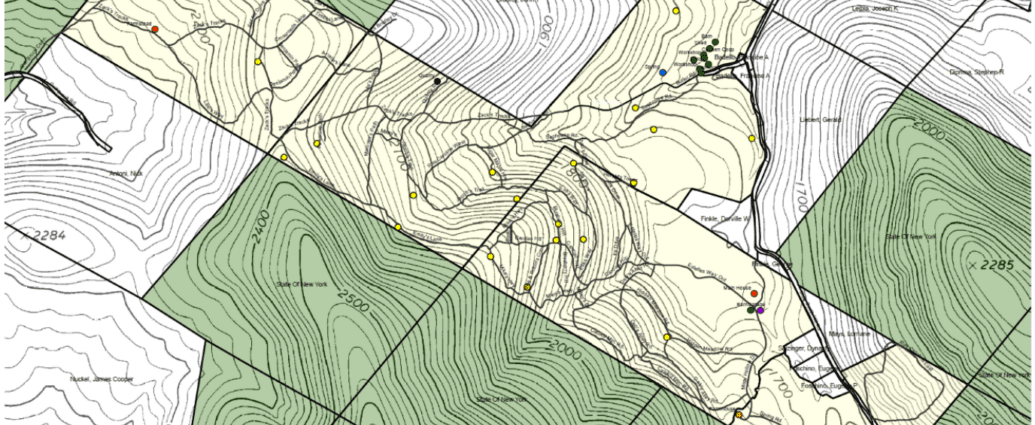
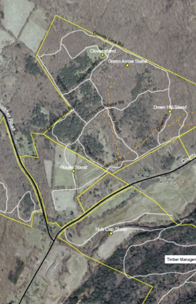
 Maps are a useful tool for navigating your property with ease and efficiency. They are also great to give to friends and family that use your land. Using high-quality GPS units, CFA can create detailed maps of your property highlighting many features and points of interest, including logging roads, hiking trails, streams, ponds, waterfalls, stands of trees, property boundaries, deer trails, and more.
Our Property Mapping Program is ideal for:
- new landowners
- properties with trails
- hunters & hunting clubs
- recreational clubs
- post-timber harvest
- caretakers & land managers
- properties larger than 15 acres
Additional Information
- Maps are available in both satellite and topographic styles. Sizes may vary.
- Please note that CFA staff are not licensed surveyors and our maps are not intended for official use.